Falcon's Paths
⛰ WebMap Dashboard ↗

Falcon's
Paths.

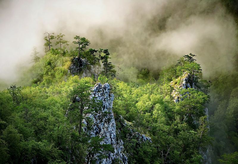
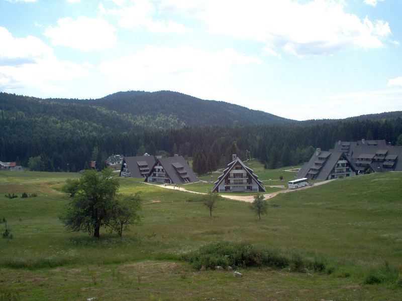
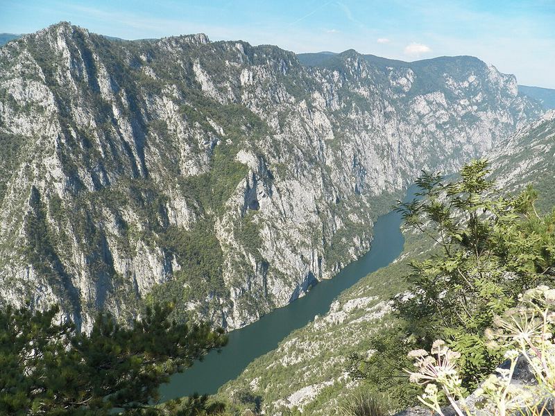
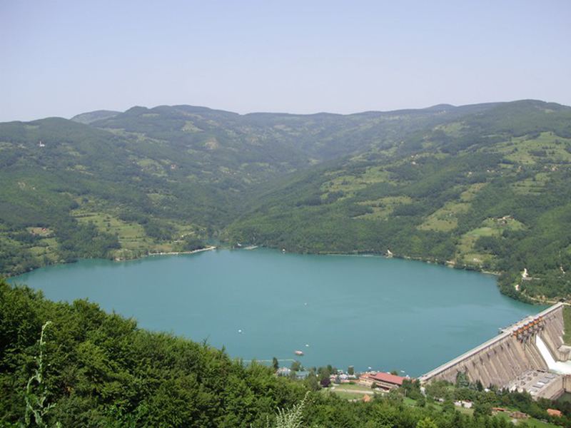
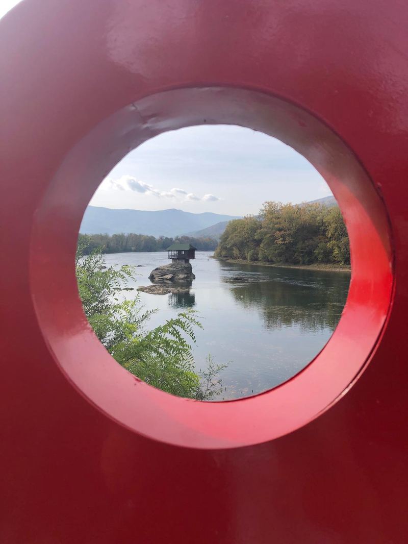
Two routes trace the limestone ridges above the Drina, climbing from river's edge to the eagle-haunted heights of Mount Tara. Ride them. Or follow every metre from here.

Layer 00 · Terrain
No track loaded
Drop GPX file to load

Drop a GPX file to begin

2D basemaps and 3D terrain, elevation profile, and stats — all client-side. Drag a .gpx file anywhere on this window, or use the buttons below.

Preset buttons require HTTP (e.g. python -m http.server). Drag-drop always works.

Layer 0A · Points of Interest
Live from OpenStreetMap · within 1.5 km of route
Live Analysis
Distance
km
Elevation Gain
m
Max Altitude
m
Checkpoints
Avg Gradient
%
Climbing sections
Layer 01 · Elevation
Hover to scrub along the route

Elevation Profile

Range
Relief
Hover to scrub · — km · — m
Layer 02 · Checkpoints
Layer 03 · The region
Eight places around the race corridor
Vidikovac Sokolarica — Falcon's ledge above the Rača canyon
Falcon's ledge
Sokolarica
The viewpoint that names the race · Rača canyon, Mt. Tara
Mt. Tara National Park
National Park
Mt. Tara
220 km² of endemic Pančić spruce forest above the Drina
Drina river canyon
Canyon
Drina
1 000 m cliffs above an emerald river · border with Bosnia
Lake Perućac
Lake
Perućac
54 km long reservoir winding through the Drina gorge
House on the Drina
Icon
House on the Drina
Tiny wooden house on a rock mid-river since 1968 · Bajina Bašta
Bajina Bašta town
Race HQ
Bajina Bašta
Start & finish town on the banks of the Drina
Drvengrad ethnic wooden village
Ethno-village
Drvengrad
Kusturica's wooden village on Mećavnik · 30 min from the course
Šargan Eight narrow-gauge railway
Heritage rail
Šargan Eight
760 mm gauge steam line climbing Mokra Gora in a figure-of-eight